In case you haven't noticed, heavy downpours are increasing in the northeast. In fact, according to the Environmental Protection Agency, they've increased by 70 percent since 1958. A heavy downpour is defined as a storm that produces two or more inches of water in 24 hours. And as temperatures warm, scientists are predicting that they'll become more frequent and intense.
To help prepare for more rain, crews have just finished an unusual 13-year survey of road-stream crossings and culverts.

With heavy rain comes the risk of more flash flooding, like the 2017 event that surprised and overwhelmed a Waterford campground when a pair of culverts failed. Video from the flash flood that cut off part of the campground was later shared on Youtube.
But inadequately-sized culverts are hardly unusual. And that's why survey crews from the Nature Conservancy, with support from the state and other organizations, have been checking out thousands of road-stream crossings and culverts around the state for the past 13 years. All their findings have been entered into a massive database that can highlight where there may be problem areas.
"Scientists among us really love to have this data, but really it's not about that, it's about trying to have healthier streams," says Alex Abbott, a stream restoration specialist with the U.S. Fish and Wildlife Service.
Abbott says the database contains about 26,000 records, making Maine one of the most comprehensively surveyed jurisdictions anywhere.
"I like to think about our watersheds in Maine as living creatures, and the rivers and streams are their veins and arteries, and these stream crossings frequently represent blockages in those veins and arteries, much like our bodies have blockages and we put stents in them," Abbott says.
In the case of streams, culverts can serve as stents, funneling heavy flows of water as well as fish. But the key for restoration and resiliency is for them to be wide enough to handle big storms.
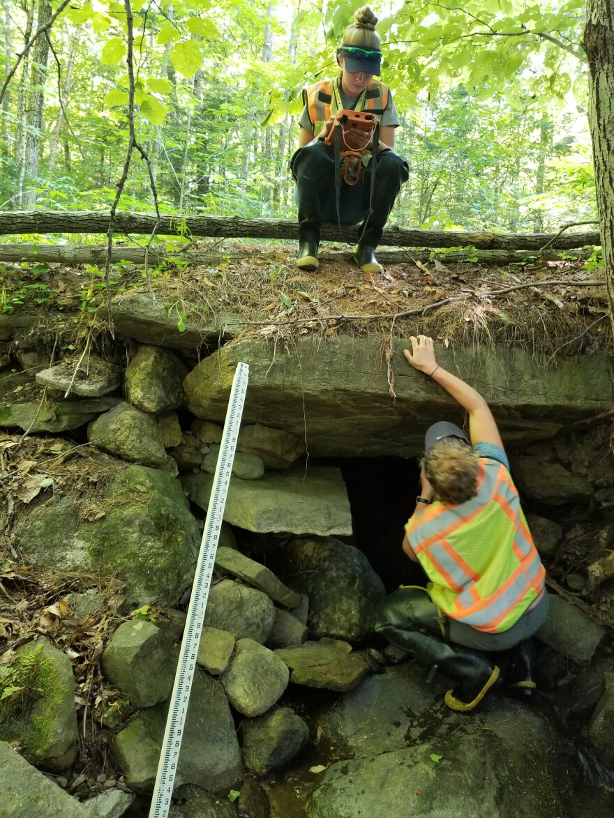
That's where Hadley Couraud and Caroline Hill come in. In the town of Hebron, in western Maine, Couraud and Hill take measurements of a stream crossing in some thick woods using what Couraud calls her "stream crew jedi sword," essentially a large measuring stick to gauge water depth and width.
This year alone, the two women and two other crews surveyed 1200 stream crossings and logged well over 1,000 miles on the road each month. By the end of September and the completion of the 13-year-project, they will have surveyed 95 percent of the stream crossings in the state.

"We've never been lost. Our tablets have GPS so on the maps we can see a little blue dot that shows where we are all the time so we always know where we are," says Hill.
Along the way, they've camped out in the North Woods and met people who live, work and hunt in their midst. Many of them have offered up places for them to stay. Couraud says she's been pleasantly surprised by how much they support the work.
"Not because they care passionately about culverts but because they understand what impact it has on the environment they grew up in,” says Couraud. “I mean we've had trophy hunters that have put us up in cabins because they know the connection between waterways and fish and bear and moose."
Hill and Couraud kept journals of the wildlife they observed in the woods while they surveyed stream crossings this summer: 30 moose, seven bears, six fox and several turtles. It's one of the benefits of their unusual job.
Last year, they built a culvert in Brownville from the ground up.
"It came to us in giant sheets of aluminum and we spent a week hand-screwing over 1200 nuts and bolts to put the thing together. It was great," says Couraurd.
And the work of the survey crews is of particular interest to Benjamin Matthews, a watershed restoration specialist with the Nature Conservancy in Maine, who uses the data gathered to help plan for the future. His own focus is on adequate fish passage.
"I've done an analysis to look at where the flood prone culverts are in the state so that I can go to the towns and say, hey, I've got a problem for fish that I want to help you with, you've got a problem for your road as well,” he says. “So, we can join these two things and really fix both of those problems at the same time."

Culverts that fail can pose problems for motorists, and also for emergency responders, delaying ambulance and fire services. And they can also cost cities and towns hundreds of thousands of dollars to replace and repair damaged roads, which is why Matthews says it makes economic sense to plan ahead for severe storms.
This story is part of a week-long reporting project“Covering Climate Now by Maine Public and more than 300 other news outlets around the world. The series comes in advance of the United Nations Climate Action Summit on Monday Sept. 23 in New York. More information here.
Originally published 5:54 p.m. Sept. 18, 2019


